
Nature discovery · In development
In developmentWILDOT拾野
Build a field guide from nature you meet
An in-development nature discovery and identification app. Capture or import a photo, review AI candidates, confirm the observation into a personal Catalog, and keep a private map footprint without exposing precise locations.
WILDOT does not have a confirmed App Store link on this website yet.
How it works
From one leaf in front of you to a personal nature footprint
WILDOT connects capture, identification confirmation, a personal Catalog and map footprints into one careful discovery flow.
- 01
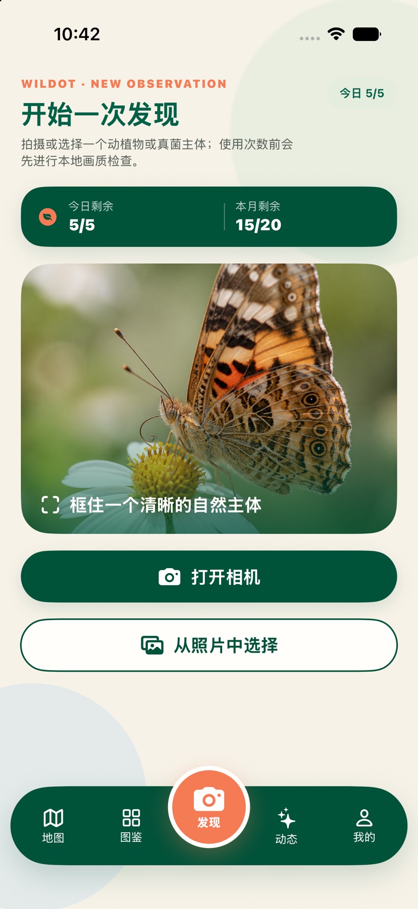
Capture or import
Point the camera at a plant, insect or another observation, or bring in an existing photo.
- 02
Confirm a candidate
Review AI candidates and context, then let the user confirm before saving an observation.
- 03
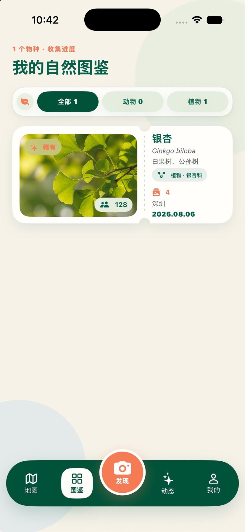
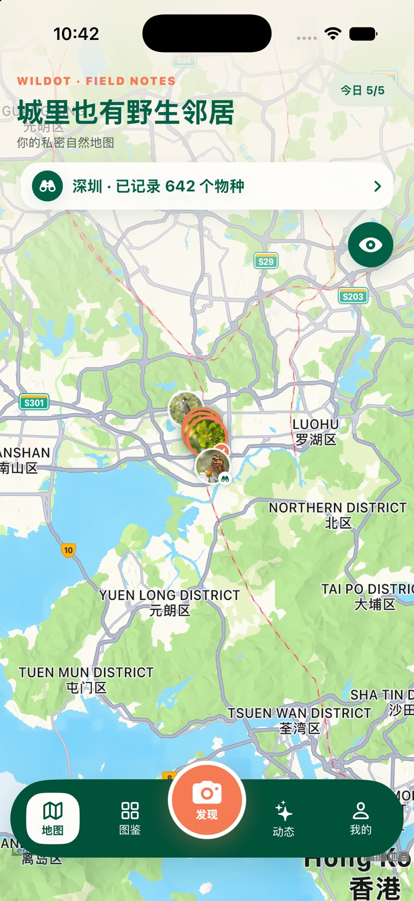
Add to Catalog and map
Keep confirmed observations in a personal Catalog and revisit them on a private map.
Current development UI
Discover, personal Catalog and private map
Three current validation screens show the path from discovery to a growing Catalog and map review.
Privacy and identification boundary
Precise locations stay private and identifications require confirmation
WILDOT is still in development. Its current direction keeps raw observations, precise coordinates and public sharing separate.
- Raw observations and precise coordinates are private by default; shared material uses only city-level or coarser location.
- Sensitive species locations use blur, delay or hiding rules instead of exposing traceable precise places.
- AI identification provides candidates and reference context. Users confirm before saving, and it does not replace expert identification.
WILDOT
Let each encounter grow into your own field guide
WILDOT is in development. A confirmed App Store link will be added to the website when available.